
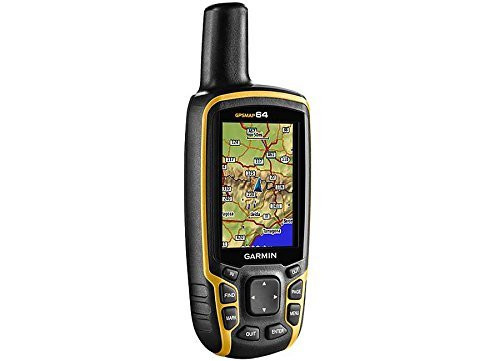

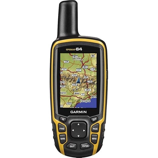


GARMIN MAP 64 Worldwide GPS Receiver
GARMIN
₹43,070.00
(Including GST)
(No reviews yet)

Write a Review

GARMIN
GARMIN MAP 64 Worldwide GPS Receiver
Garmin GPSMAP 64 Worldwide GPS Receiver – Professional Handheld Navigation System
The Garmin GPSMAP 64 Worldwide GPS Receiver is a rugged, full-featured handheld navigation instrument engineered to deliver exceptional positioning accuracy across challenging environments. Designed for scientific field research, geomatics, industrial surveying, and serious outdoor exploration, this solid-state tracking device integrates high-sensitivity GPS and GLONASS receivers with an advanced quad helix antenna for rapid satellite signal acquisition and reliable location tracking.
Equipped with a brilliant 2.6-inch sunlight-readable color screen, the GPSMAP 64 remains visible in all lighting conditions, from high-glare field environments to dense canopy cover. Its durable housing features an IPX7 water rating, shielding sensitive electronics against accidental moisture entry during extreme field assignments. The receiver comes loaded with a built-in worldwide basemap with shaded relief, supporting seamless photo navigation workflows through geotagged images downloaded directly to the unit.
To support prolonged fieldwork deployments, the Garmin GPSMAP 64 boasts a 16-hour battery life powered by versatile AA cells, with high-capacity NiMH or Lithium configurations recommended. With 4 GB of internal memory expandable via a dedicated microSD™ card slot, users can easily deploy detailed topographic, marine, or road map architectures, making it a reliable precision data logger for remote surveying applications.
Technical Specifications
| Feature | Details |
|---|---|
| Product Architecture | Garmin GPSMAP 64 Worldwide GPS Receiver |
| Receiver Type | High-sensitivity GPS & GLONASS with Quad Helix Antenna |
| Display System | 2.6" Diagonal, Transflective, 65K Color TFT Display |
| Display Resolution | 160 x 240 Pixels |
| Environmental Protection | IPX7 Certified Water Resistance; Rugged Field Enclosure |
| Internal Storage | 4 GB High-Speed Flash Memory |
| Memory Expansion | microSD™ Card Slot (Cards Not Included) |
| Power Management | 2 AA Batteries (NiMH or Lithium Recommended) |
| Operational Runtime | Up to 16 Hours Continuous Track Logging |
| Data Interfacing | High-Speed Mini USB Port; NMEA 0183 Device Compatible |
| Preloaded Content | Worldwide Basemap with Shaded Relief; 250,000 Geocaching.com Caches |
| Map Compatibility | Garmin Custom Maps, TOPO 24K/100K, BlueChart® g2, City Navigator NT® |
| Physical Dimensions | 2.4" x 6.3" x 1.4" (6.1 x 16.0 x 3.6 cm) |
| Instrument Weight | 8.1 oz (230 g) with Batteries Installed |
Core Features & Technical User Benefits
The Garmin GPSMAP 64 is configured to address critical accuracy challenges, signal failure under heavy cover, and field map data limitations.
- Dual GPS & GLONASS Dual-Core Tracking Combines two satellite constellations to lock on positions faster than GPS alone, maintaining precision coordinates inside deep canyons and dense forest environments.
- High-Gain Quad Helix Antenna Array Optimizes omnidirectional reception, eliminating signal drop-off regardless of hand placement or equipment orientation during critical field operations.
- Transflective Sunlight-Readable Display Leverages ambient natural light to boost screen clarity, ensuring complete menus and map readability under bright mid-day sun while cutting battery draw.
- Expandable 4GB Flash Framework Hosts extensive TOPO 24K geological profiles, BlueChart® marine charts, and custom vector grids without choking storage, thanks to the microSD™ slot.
- Turnkey Paperless Geocaching Matrix Houses 250,000 factory-loaded caches with full descriptions and coordinates. This removes manual logging errors and streamlines field target testing.
- IPX7 Rugged Submersible Enclosure Built to withstand harsh field work, surviving accidental water entry down to 1 meter depth for up to 30 minutes without operational disruption.
Frequently Asked Questions & Search Verification
How does the Garmin GPSMAP 64 maintain a satellite signal lock under heavy cover or dense canyon environments?
The Garmin GPSMAP 64 Worldwide GPS Receiver achieves superior signal stability by pairing a high-gain quad helix antenna with a dual GPS and GLONASS tracking module. This design opens access to twice as many tracking satellites as standard single-network receivers, ensuring accurate positioning even under thick tree layers or near tall urban infrastructure.
This systematic dual-constellation alignment limits signal drift, keeping positional errors to a minimum during precise mapping or survey routing.
What kind of maps can be added to the Garmin GPSMAP 64 internal memory?
The Garmin GPSMAP 64 features 4 GB of internal storage and an expansion microSD card slot, enabling simple integration of detailed TOPO 100K maps, BlueChart g2 marine arrays, and City Navigator NT road data. It also supports Garmin Custom Maps, allowing you to convert paper map files into active digital data layers for free.
This broad compatibility ensures your field teams can load highly localized geographical information for any project site globally.
Is the Garmin GPSMAP 64 waterproof rating suitable for severe wet weather field deployments?
Yes, the Garmin GPSMAP 64 is built with a rugged, drop-tested housing rated at IPX7 water resistance. This international standard certifies that the handheld device completely seals out moisture during heavy downpours, sleet, or accidental submersions in up to 1 meter of water for 30 minutes.
This tough structure ensures uninterrupted analytical logging for scientists and environmental teams working in unpredictable field conditions.
How does the paperless geocaching feature function on the Garmin GPSMAP 64 receiver?
The Garmin GPSMAP 64 comes preloaded with 250,000 distinct geocaches directly from Geocaching.com, storing key parameters like coordinates, localized terrain grades, specific cache hints, and full descriptions inside the device. This approach eliminates manual data-entry errors, removes the need for paper printouts, and enhances operational efficiency.
Field users can access clear on-screen hints quickly, saving time during target retrieval runs.
What type of batteries should be used to achieve the maximum 16-hour runtime?
The Garmin GPSMAP 64 is engineered to run up to 16 continuous hours on 2 standard AA batteries. For the most stable voltage delivery and extended battery life, high-performance NiMH rechargeable cells or premium Lithium batteries are highly recommended, especially when working in low-temperature environments.
Carrying extra AA batteries ensures your field operations can continue indefinitely without needing an electrical outlet.
-
-
-
Garmin GPSMAP 65s Handheld GPS – Multi-Band Accuracy, ABC Sensors, Topo Maps
₹59,000.00 (Including GST)GARMIN
-
Garmin eTrex 30x Handheld GPS | 3-Axis Compass, GLONASS, Long Battery Life
₹39,530.00 (Including GST)GRAMIN


